Lincoln In Enhanced Risk For Severe Weather on Wednesday Night
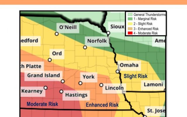
LINCOLN–(KFOR May 26)–Make sure you pay attention to the sky on Wednesday night, as Lincoln and portions of southeast Nebraska are under an enhanced risk for severe weather.
Katie Gross, a meteorologist at the National Weather Service in Valley, tells KFOR News storms could move into the Lincoln metro area by late Wednesday evening into early Thursday morning.
“They could bring some really strong, damaging wind gusts, large hail, maybe an isolated tornado or two and the possibility of heavy rainfall, as well,” Gross said.
The timeline for thunderstorms in Lincoln could be sometime after 10pm and into the overnight hours. Gross suggests having as many sources as possible to keep you updated on the weather situation, especially overnight. “Just in case if your initial wave fails, so it’s good to know what’s going on,” Gross added.
Remember to keep it tuned to KFOR FM103.3/1240AM, kfornow.com and our social media platforms on Facebook and Twitter, to keep up to date on watches and warnings. You can also receive text alerts by texting the word WARNING to 88474.