Storms Race Through Lincoln Metro, Eastern Nebraska Wednesday Afternoon
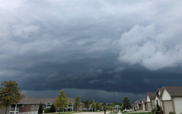
LINCOLN–(KFOR Dec. 15)–A major, spring-like squall line of severe thunderstorms made an unusual December appearance across much of Nebraska on Wednesday afternoon, causing strong gusty winds and at least two unconfirmed reports of tornadoes.
The first of the tornado warnings were issued in south-central Nebraska around 1:15pm, as the squall line had moved up from north-central Kansas and grew northward, extending back to southern Kansas. Tornado warnings were issued for Franklin, Webster and Adams counties, before the threat moved up toward the Hastings and Grand Island areas. There were reports of a possible touchdown near Trumbull, which is nine miles northeast of Hastings. Hall, including Grand Island, along with Howard, Hamilton and Merrick counties were under tornado warnings, before the line of storms moved eastward.
Storms reached the Lincoln metro area around 3pm, which prompted severe thunderstorm and tornado warnings. The National Weather Service issued a tornado warning for northwestern Lancaster County and east-central Seward counties at 3:20pm, after radar indicated a possible tornado near Pleasant Dale or nine miles west of Lincoln moving northeast between 65 to 85 mph. As the storm moved through northwestern Lancaster County, heavy rain and winds picked up considerably. As of 4:15pm Wednesday, there were no confirmations of a tornado touching down in Lancaster County.
Winds did damage tree limbs and knocked out power to homes across the Lincoln metro area. As of 4pm, there were 6,300 Lincoln Electric System customers that had no power. If you have an outage to report, call 1-888-365-2412 or go to les.com. Click here to see the outage map.
Tornado warnings were also posted for portions of Douglas, Saunders, Dodge and Washington counties, as the storms moved into the Omaha metro area. There was a report of a tornado touchdown south of Mead in Saunders County.